


I hope you had a great Easter.
Mrs Swade and I got away for a few days, to visit an area south of Hobart called The Channel. It’s actually called the D’Entrecasteaux Channel, but people have trouble saying D’Entrecasteaux and just called it The Channel.
Van Diemen’s Land – as Tasmania was originally known – was actually first discovered by Westerners in the 1640’s by a Dutch bloke named Abel Tasman, from whom our island now takes its name. Bruny D’Entrecasteaux (not his full name) was a French explorer who sailed through the channel that bears his name 150 years later. Tasman probably could have claimed the island for the Dutch in the 1600’s if they had a need for it, though the English had already claimed the whole of Australia by the time Bruny D’Entrecasteaux dropped in.
Anyway…..
The Channel region starts about 20 minutes south of Hobart and continues on some glorious roads as the Tasmanian mainland runs parallel to the northern half of Bruny Island, also named after you-know-who. See the map, below. The northern end of The Channel is roughly where North West Bay is marked on the map.
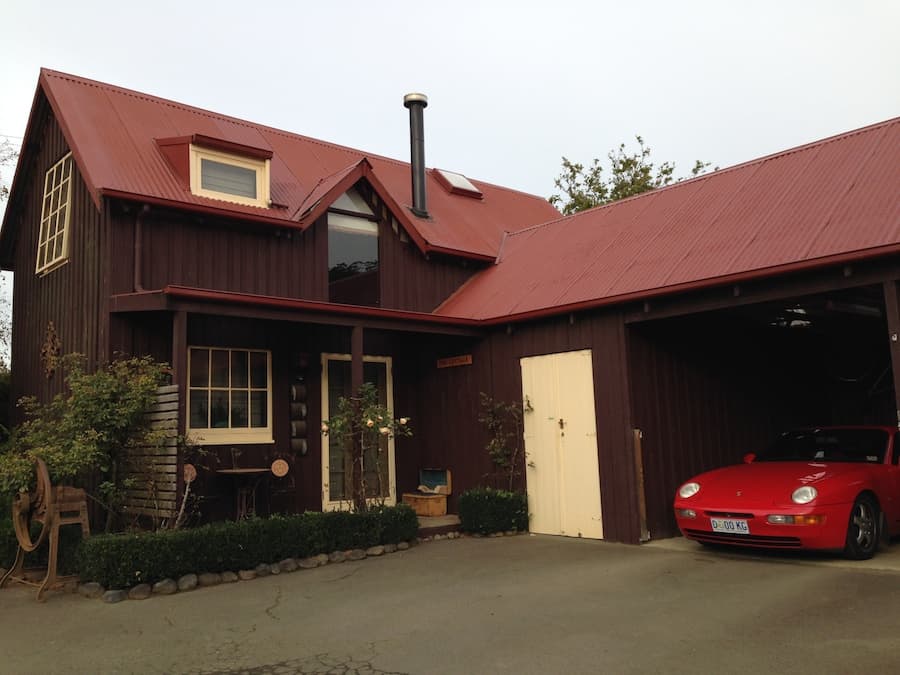
Mrs Swade and I stayed at a delightful little B&B called Clear Creek Cottage, in a town called Woodbridge. I’m happy to give Tony and Liz a shout-out as they were wonderful hosts. The 968 was right at home there and I’d like to make myself at home in the region, too.
On day 2 we made our way to Kettering to catch a ferry to Bruny Island. Bruny (you don’t say the island bit, usually) is two main land masses joined by a thin strip of land known as ‘the 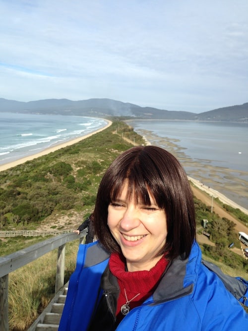
Right: Mrs Swade, her neck, and ‘the neck’.
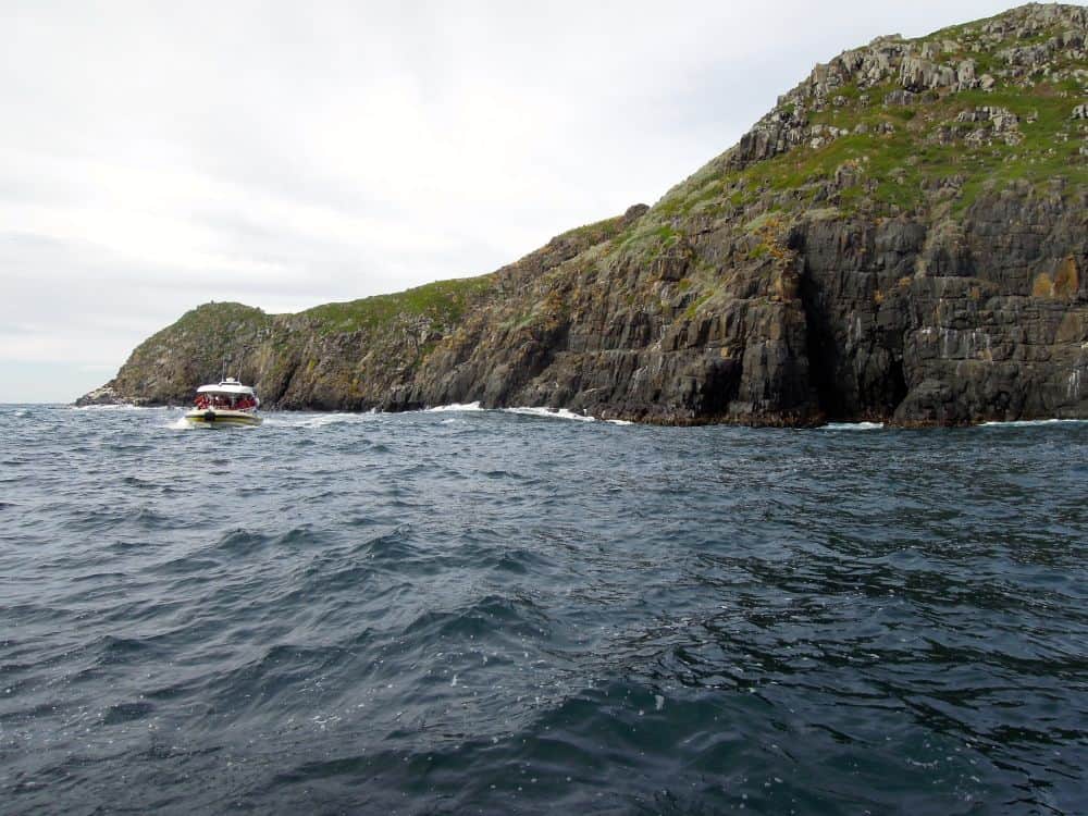
We had a booking for a 3-hour wilderness cruise along Bruny’s south-eastern coast. The south-east of the island is all national park so there are no inhabitants and no proper roads. It’s all massive cliffs, massive hills and dense bush.
The cruise started at Adventure Bay, which I’ve tagged on the map, below. From there we basically hugged the coast of the island all the way down to the south-eastern tip, which form the basis of the pictures you’re about to see.

The gallery that follows is a mere 30 photos out of 100 that I took but hopefully it’ll give you a good overview of the amazing scenery we saw on the day. The rock is mostly dolerite with some of the rock formations aged at around 240 million years! The fur seals at the end are quite a bit younger.
Click to enlarge.


